Russian billionaire Arkady Rotenberg has reportedly invested US$28m in domestic remote sensing specialist RDC ScanEx. According to Russian daily Kommersant, the real estate and infrastructure investor will take control of 90% of the company with the…
Russian billionaire Arkady Rotenberg has reportedly invested US$28m in domestic remote sensing specialist RDC ScanEx.
According to Russian daily Kommersant, the real estate and infrastructure investor will take control of 90% of the company with the remainder being retained by ScanEx’s founders Vladimir and Olga Gershenson.
The company was not available for comment at the time of going to press.
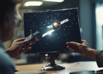
Established in 1989, ScanEx provides earth observation and imaging services to both the Russian government and commercial entities, such as search engine Yandex. It is the only company in Russia that has signed licence agreements with the major remote sensing operators including DigitalGlobe, Astrium, ImageSat International, MDA Geospatial Services and KARI.
In addition, ScanEx owns and operates a network of more than 50 ground stations across Russia.
The company has seen strong growth over the past couple of years with revenues doubling from 2009 to 2010 and increasing again in 2011 to Rbs1.162bn (US$36.6m) with a net profit of Rbs101.5m (US$3.2m).
According to the newspaper, ScanEx has recently been embroiled in a legal dispute with its biggest customer Rosreestr, the Federal Service for State Registration, Cadastre and Cartography. The department had made a Rbs100m (US$3.1m) claim against ScanEx over an order for a new cadastre but it has since been rejected by an arbitration court.
Local media have claimed that Rotenberg’s investment is connected to the announcement by the Russian government earlier this month approved a federal programme to develop a unified state system of mapping and registering the country’s real estate and the rights to it.
Taking place between 2014 and 2019, the plan is estimated to cost around Rbs54bn (US$1.68bn) and ScanEx is expected to bid to provide the necessary satellite imagery.